

Welcome back to National Parks and other public lands with T!
Wrangell–St. Elias National Park►
The Alaska National Interest Lands Conservation Act of 1980 established Wrangell–St. Elias National Park and Preserve in south central Alaska. At over 13 million acres, Wrangell-St. Elias covers the largest area managed by the National Park Service. Its area makes up over 15% of all national park land in the United States.

The park includes the Saint Elias Mountains, with most of the highest peaks in the United States and Canada. Mount Saint Elias stands at over eighteen thousand feet. The mountains run steeply down to the sea, with only 10 miles of separation. The main distinction between park and preserve lands is that sport hunting is prohibited in the park and permitted in the preserve.
Volcanoes and glaciers both shaped Wrangell–St. Elias. The Bagley Icefield covers much of the park’s interior, which includes 60% of the permanently ice-covered terrain in Alaska. Mount Wrangell is an active volcano, one of several volcanoes in the park. There are several glaciers within park boundaries including Hubbard Glacier, the longest tidewater glacier in Alaska.

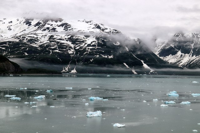
The day after we sailed Glacier Bay National Park, our cruise ship entered Disenchantment Bay and took us to the Hubbard Glacier. It was considerably colder up on deck than it had been in Glacier Bay. We were awed by the sheer immensity of Hubbard!

Wrangell–St. Elias Posts►
- Wrangell–St. Elias National Park
- Hubbard Glacier

Location: South Central Alaska
Designation: National Park and Preserve
Date designated/established: December 2, 1980
Date of my visit: June 5, 2022

Awesome photos, T!
Thanks!
Great post!
Thanks! 🙂
This must be so impressive to see for oneself.
Thanks, yes it is breathtaking
Pingback: Wrangell–St. Elias National Park: Hubbard Glacier - National Parks With T