

Welcome back to National Parks and other public lands with T!
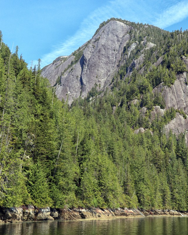
Rudyerd Bay sits within Misty Fjords National Monument and the Tongass National Forest. Glaciers formed this bay and there is also evidence of ancient lava flows.

President Carter declared Misty Fiords a national monument in 1978 under the Antiquities Act. Then the state of Alaska fought the federal government over land rights. Under the 1980 Alaska National Interest Lands Conservation Act, the designation changed to Misty Fjords National Monument. And it also reduced the monument’s size slightly.


Historically, the Tlingit people occupied this region. Their history dates back almost 10,000 years. The native name for this place is Xena.
We arrived in Rudyerd Bay on the St. Nona, courtesy of the Allen Marine Tour Company. The only way to explore Misty Fjords is by boat or sea plane. The more ambitious kayak, but it’s 40 miles away from Ketchikan.


In Rudyerd Bay, we were surrounded by towering granite cliffs, lush greenery, and waterfalls. To our delight, we found ourselves sharing the space with a pod of orcas. We lingered there, watching them play, for some time. A lone seal pulled up onto a beach nearby. Then it was time for us to head back to Ketchikan.
Ketchikan posts►
- Misty Fjords
- Behm Canal
- New Eddystone Rock
- Rudyerd Bay
- Tongass
Location: East of Ketchikan, Alaska
Designation: National Monument
Date designated/established: December 5, 1978
Date of my visit: June 1, 2022

Pingback: Rudyerd Bay — National Parks With T – ° BLOG ° Gabriele Romano
👏👏👏📷🏞️🐋🐳
💙💙💙
Majestic views, with great views of orca. I’m very jealous! 🙂
Thanks! We were so thrilled to see them!
The remoteness of this natural treasure must make it all the more pleasant to visit. Great photography.
Stewart
Thanks Stewart! It was a wonderful visit…worth the 90 minute boat ride to get there
Seeing whales (and orcas) is such a thrill! Thank you for sharing.
It was so exhilarating to see them! Thanks for reading and commenting 😃
The videos were captivating.
Thanks 😊
Nice Post 🤠
Thanks 😊
Thank you for those photos! I lived in AK for six years and visited many places, but never there.
Thanks! Lucky you got to spend time in AK
Loving your journey through Alaska, T. I lived there in the 8os and backpacked into may wild areas. It is an incredible state. –Curt
How fantastic that you had the opportunity to see Orcas up so close in such beautiful surroundings.
Wow! What a treat it must have been when the whales showed you more than just a spout of water shooting out of the ocean’s surface. Beautiful.